Wednesday, February 12, 2014
Sorry there's no blog post this week. We are up to our eyebrows in work that needs to be done before the temple closes this Saturday evening for the annual two-week maintenance and refurbishment. We will be traveling to Macchu Picchu and Lake Titicaca during the break, so I'll have lots of good pictures starting February 25th. 'Til then, vaya con Dios!
Monday, February 3, 2014
Last Monday (January 27) we took a road trip (paseo, en español) to Incallajta (In-ka-yahta), which was the southeastern-most fortification of the Inca Empire. With our usual luck - and because it is summer here in the Southern Hemisphere - it rained ALL day. In order to let you see Incallajta at its best as well as its worst, I have co-opted some of my friend John Norman's photos from the day he was there last summer (the dry season). So when you see a sunny-day picture, he took it; the ones that are gray and rainy are mine. Thank goodness for friends who happily share their pictures!
We left the hospedaje at 7:00 in the morning. It was a 3-hour ride, so we saw a lot of scenery - some, really beautiful like this . . .


 There were many homes built right alongside the highway. Animals are everywhere; there is nothing like "zoning", of course.


This is a picture John took of a native woman moving her cow from one grazing spot to another.


Climbing out, in the rain . . .


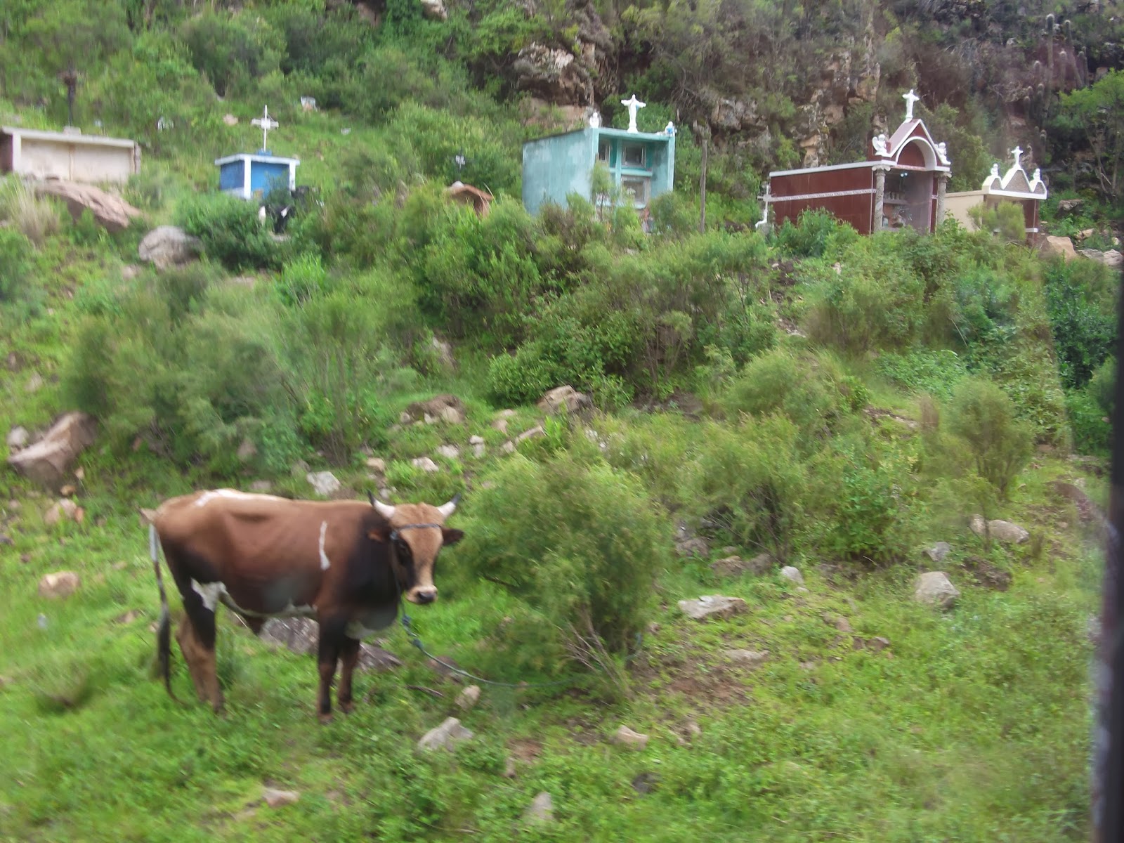
When we got back to the bus we all ate the lunches we had brought (there is no place to buy any kind of food or drink here, nor for miles in any direction. Obviously not your "North American" type of tourist attraction.) Then we started the 3-hour drive back. Just before we got to the main highway (it's a 10-mile cobblestone road from the highway to the park entrance), we passed this graveyard. All the graves are above ground (maybe it's too wet here to make underground burial possible?) Anyway, there were many more than these, but this is a representative sample.
The next three pictures are of cool things John's group saw on their way home. We didn't see anything but rain and mud, but I want to share these with you because I know you will be interested. First, this girl is mashing chuno to loosen the outer peel. This is a small potato that is peeled and "freeze-dried" in the open air. It allows the people to preserve food and obviously is still eaten today. She mashes them with her feet after they are peeled (and no, I don't think they do anything about "sanitizing" them before freeze-drying OR eating them.)


All in all it was a great experience in spite of the rain.
That's all for today. Have a safe, happy, healthy week . . . y vayan con Dios!
We left the hospedaje at 7:00 in the morning. It was a 3-hour ride, so we saw a lot of scenery - some, really beautiful like this . . .
. . . and some not-so-beautiful but very much the norm in the campo (countryside), like this.
We saw several flooded areas. Believe it or not, there are homes back among those trees.
And this is a lake we passed.
There were restaurants along the shore, offering trout dinners. I wouldn't want to eat a trout that came out of this, would you?
For example,
there were many houses with cows,
sheep and/or pigs tethered in front.
This was one of the beautiful vistas. Notice the small farms here and there.
We saw quite a few fields of this stuff that looks like the mustard plants we have at home. Nobody on the bus knew what it was, but we're pretty sure it is a cash crop, not a weed.
These also are a real crop (not weeds). These are bean plants. The beans when harvested are about the size of lima beans and taste quite similar. Can't for the life of me remember the Spanish word for this plant.
This is one of many potato fields we passed. Potatoes are the staple of this region,
both for marketing and for home use. There are something like 2,000 varieties of potatoes in Bolivia.
This is just to show you how they use the land.
Some of these hills are so steep, I can't imagine cultivating there.
However, they do everything by hand, so I guess that's how they manage.
This is a picture John took of a native woman moving her cow from one grazing spot to another.
Finally we got to the park and couldn't drive the last little way to the entrance,
because the river was too flooded for the bus to go through.
The driver said this is the first time he hasn't been able to drive all the way to the entrance,
though some of the boulders you can see make me wonder how he could cross this river
even if the rain hadn't made it higher than usual.
Anyway, we got out here and walked the rest of the way.
This is the suspension bridge the government has provided for park visitors when the bus (or cars) can't get through. L/R: Dawn Hurst, Rene Cabrera, Teresa Cabrera, Lynda Westover, Glen Westover, me, Rosario Garcia, Martin Paredes, Isabel Paredes, and Luis Garcia. Please note that I am not alone in the "floppy hat" category. Hermana Garcia's hat was every bit as floppy as mine (to my great relief.) FYI: Rene Cabrera is the Temple Recorder (extremely-responsible position) and Luis Garcia is the First Counselor in the Temple Presidency. All the others are temple missionaries.
This young couple had walked from somewhere and came up with us at the swinging bridge.
Notice how she's carrying the baby. The shawl is called an aguayo.
We see women ALL the time - in the city and out - carrying not only babies (up to and including toddlers) but also big loads of produce and many other things.
Here we are just starting up the trail after checking in at the entrance and paying our fee. I am the third from the left (you can always spot my floppy hat), and Farron is behind me. His hat has a scarf-type thing that hangs down in back to protect his neck from sunburn (or in this case, from rain.)
Speaking of rain,
here's a shot of Sister Westover and me with our cute little guide, Ruby Tudela. She is studying tourism at the university and saving money so she can go on a mission. Hosting these missionary paseos helps a little.
The wall of the Kallanka.
This was a huge rectangular building, the largest known roofed structure
built by the Incas. Notice the wall niches--44 in all. You can see the dimensions of this building --it was
HUGE. It is suggested that it was used
for public or administrative meetings or even as a theater. This is one view in the rain . . .
. . . and here's what it looks like from the other end, in the sunshine.
This is the end wall of the Kallanka, which had a thatched
roof.
There were pillars down the center of this long building, but they are all gone.
These long niches in the walls were thought to hold idols.
(Can you see me - 3rd from right - scrunched back in the niche to get out of the rain?
It worked, too. Only my legs got wet and it was raining quite hard right then.)
Farron is in the blue poncho, 2nd from the right.
This is an altar - as in "sacrificial altar". Toward the end, I believe the Incas were sacrificing virgins as did the Aztecs. In these (modern) days, they still have ceremonies up here - to bring in the planting season and pray for good crops, etc. - but they sacrifice baby llamas. Incidentally, this rock is not big enough for a person to stretch out; the sacrificial victims must have had to be very small or curled up in a fetal position.
These are thought to be residential areas on the site. (That's our friend John, who took the sunny pictures.)
The ruins are built in a small valley, surrounded by mountains. People still live and farm here, using irrigation.
The canopy is covering a section of the wall of the Kallanka
which still has some of the red plaster covering the stones. This red plaster was common in Incan buildings. That's Farron in the blue poncho.
After we had walked around all the above ruins, we hiked about 150 yards
to a steep set of rock steps that took us down the side of a narrow canyon
to the bottom of this waterfall. Our camera doesn't accurately portray the height of the waterfall.
It was at least 100 feet high (which makes sense, since the steps up out of the canyon
totaled exactly 100.) We were glad for the newly-installed handrail,
both going down and coming up (but especially going down,
because in the rain, the steps were slick.)
Looking back at the waterfall - you can almost sense how high it was.
Climbing out, in the rain . . .
Our guide told us the Incas used this canyon as a barrier to protect themselves from attackers. She showed us an observation point about halfway up a cliff (about 50 yards past the top of these steps). When the sentries saw enemies coming, everyone non-military on this side of the canyon went over on the other side for safety (back by the Kallanka) and the soldiers came to the west side to fight the battles (away from the residences and the administrative buildings.)
On the way back everyone stopped at the park entrance to use the rest rooms again
(the only opportunity for 3 hours!)
This indigenous lady, who collects the fees from visitors, was sitting on the floor reading her Bible.
Brother Westover took two videos of her - in the first one, she sang in her native Quechua a hymn praising God. In the second one, she was demonstrating how she turns wool into yarn using the hand spindle you can see to her right. (I assume she also had previously carded the wool - or someone like her had done so.) I tried uploading the videos but can't get them to work. If anyone reading this knows the secret, please post it in a comment and I will try again. I'd really like you to see them.
When we got back to the bus we all ate the lunches we had brought (there is no place to buy any kind of food or drink here, nor for miles in any direction. Obviously not your "North American" type of tourist attraction.) Then we started the 3-hour drive back. Just before we got to the main highway (it's a 10-mile cobblestone road from the highway to the park entrance), we passed this graveyard. All the graves are above ground (maybe it's too wet here to make underground burial possible?) Anyway, there were many more than these, but this is a representative sample.
The next three pictures are of cool things John's group saw on their way home. We didn't see anything but rain and mud, but I want to share these with you because I know you will be interested. First, this girl is mashing chuno to loosen the outer peel. This is a small potato that is peeled and "freeze-dried" in the open air. It allows the people to preserve food and obviously is still eaten today. She mashes them with her feet after they are peeled (and no, I don't think they do anything about "sanitizing" them before freeze-drying OR eating them.)
Here are the ladies peeling the potatoes.
You can see them laid out on the blue tarp on
the right so that they will dehydrate somewhat
before the girl starts trying to mash them.
before the girl starts trying to mash them.
And here is a farmer preparing his land for planting (last summer.)
Remember the growing season is reversed here.
Remember the growing season is reversed here.
They still plow by oxen and wood plow.
By contrast, this is what we saw when we finally got back to the edge of civilization.
Rain and mud - the two are inseparable here -
and in my mind one of the most unattractive features of living in this country.
The reason it's muddy everywhere is that so many streets (in fact, the majority) are not paved.
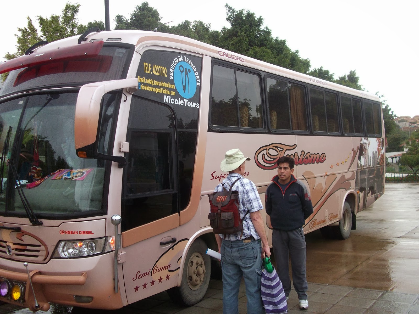
And here we are back at the hospedaje.
Notice the nice clean pavement under the bus, in spite of all-day rain.
This is one of many reasons we are SO blessed to live on the temple grounds!
All in all it was a great experience in spite of the rain.
That's all for today. Have a safe, happy, healthy week . . . y vayan con Dios!
Subscribe to:
Posts (Atom)